Past Summit Speakers
2011
Adena Schutzberg - of Directions Magazine, Max Baber-from US Geospatial Intelligence Foundation, Alyssa Wright-of OpenGeo, Kyle Schmackpfeffer - from ITT Geospatial Systems, Nicolas de Monchaux- from UC Berkeley, Mike Dobson- of TeleMapics LLC, and Learon Dalby- from the Arkansas Geographic Information Office.
2010
James Fee - WeoGeo, Ted Morgan - Skyhook Wireless, Stu Rich - Penobscot Bay Media, Nicholas Roy - Associate Professor of Aeronautics and Astronautics Department of Aeronautics and Astronautics, Jason Hyon - NASA/JPL Earth Science and Technology
2009
Anne Hale Miglarese - Booz Allen Hamilton, Jim Geringer - ESRI, Ronald Beck - USGS, Art Kalinski - Pictometry International, Adam Szofran - Microsoft, Dr. David Miller - SUNY Cortland, Adena Schutzberg - Directions Magazine
2008
Jack Dangermond - ESRI, Allen Carroll - National Geographic, Ed Parsons - Google, Vincent Virga - Author
Adena Schutzberg - Directions Magazine, Eric Sanderson - Mannahatta Project, Don Rittner - Onrust Project
2007
Mark Anderson - Nature Conservancy, Don Cooke - Geographic Data Technology, Derrick Crandall - American Recreation Coalition, Erin Aigner - The New York Times, Michael Jones - Google Earth, Adena Schutzberg - Directions Magazine, Jim Lorenz - Microsoft's Virtual Earth, Richard Iuli - The Climate Project®, Kris Hughes - Director of the Ontario County Planning Dept.
2006
Richard Kaplan - Pictometry, Jay Benson - TeleAtlas, George Moon - MapInfo, Chris Cappelli - U.S. Sales ESRI, Michael Jones - Google Earth, Tom Barclay - Microsoft Virtual Earth, Bill Johnson - NYSGIS, Ian White - Urban Mapping, Adena Schutzberg - Directions Magazine, Todd Fabozzi - Capital District Regional Planning Commission, Ross Whaley - Adirondack Park Agency
2011 Speakers

Max Baber is Director of Academic Programs at the United States Geospatial Intelligence Foundation (USGIF), managing accreditation of university Geospatial Intelligence (GEOINT) certificate programs and supporting related academic initiatives. Dr. Baber received a Ph.D. in Geography from the University of Georgia in 1999 and an M.A. in Geography from Georgia State University in 1993. He has served in faculty appointments with the Master of Science in Geographic Information Systems program at the University of Redlands and Departments of Geography at Samford University and the University of Northern Colorado. He has developed and implemented a number of pedagogical geographic information science projects supported with funding from a number of sources including the National Science Foundation. He is a member of the U.S. National Committee for the International Cartographic Association (USNC-ICA), serves on the board of directors for the Cartography and Geographic Information Society (CaGIS), and is a Fellow of the British Cartographic Society (BCS).
 Alyssa Wright is a graduate of MIT's Media Lab and NYU's Interactive Telecommunications Program, Alyssa comes to OpenGeo with breadth and wealth of experience in information architecture, editing, graphic and interaction design, and project management.
She leads product management of the OpenGeo Suite, while also managing diverse client accounts. Cartography/Research - Helped coordinate the digital acquisition of New York City maps from the 1600s to present day. Simplified GIS data for movie sponsored by the City Museum of New York. Administration/Coordination/Design - Operated as a liaison between students, faculty and staff of the Institute of Film and Television at the NYU Graduate Film Department. Flexible presentation skills, ranging from written correspondence and budget spreadsheets to interior design and event planning. Interaction/Project Management - Monitored various websites within the interactive arm of Messner Vetere Berger McNamee Schmetterer. Managed quality standards of current sites while assisting with the research and production of upcoming campaigns.
 Nicholas de Monchaux, assistant professor of Architecture and Urban Design at UC Berkeley, is an architect and urbanist whose work examines the intersections of nature, technology, and cities. Fascinated by the persistent failure of architects to grasp and instrumentalize the complex nature of urban environments, de Monchaux's work examines the particular role of architecture in civic transformation.
de Monchaux's Local Code/Real Estates, a parametric study of ecologically transformed "gutterspace" was a finalist in the WPA 2.0 Competition in 2009 and was featured at the 2010 Biennial of the Americas. Through the use of GIS, de Monchaux has identified thousands of publicly owned abandoned sites in major US cities and imagines this distributed, vacant landscape as a new urban system. Using digital design techniques, a landscape proposal for each site is tailored to local conditions, optimizing thermal and hydrological performance to enhance the whole city's ecology-and relieving burdens on existing infrastructure. Local Code's quantifiable effects on energy usage and stormwater remediation eradicate the need for more expensive, yet invisible, sewer and electrical upgrades. In addition, the project uses citizen participation to conceive a new, more public infrastructure as well-a robust network of urban greenways with tangible benefits to the health and safety of every citizen.
de Monchaux received his B.A. with distinction in Architecture, from Yale, and his Professional Degree (M.Arch.) from Princeton. He has worked as a designer for Michael Hopkins & Partners in London, and Diller, Scofidio + Renfro in New York. de Monchaux's work has been published and reviewed in Log, Architectural Design, the New York Times, and the Wall Street Journal, and have been supported by the Graham Foundation for Advanced Studies in the Fine Arts, the Macdowell Colony, the Santa Fe Institute, and the Smithsonian Institution. He has received design awards and citations from the International Union of Architects, Pamphlet Architecture, and the Van Alen Institute, who awarded him the 2000 John Dinkeloo Memorial Fellowship at the American Academy in Rome.
He is the author of Spacesuit: Fashioning Apollo (MIT Press, 2011), an architectural history of the Apollo 11 spacesuit, that was recently featured on NPR's Science Friday with Ira Flatow. His biography and collected works, together with interactive downloads of the Local Code/Real Estate project, are available at nicholas.demonchaux.com.
 Michael W. Dobson, Ph.D.
President, TeleMapics LLC is recognized expert in mapping and GIS with over twenty-five years of experience in business, government and research dealing with issues and applications of geographic data for use in the development of market leading products, tools and services.
Selected Professional experience
Chief Technology Officer and Executive Vice President of Engineering, go2 Systems, Inc.
Served as corporate officer responsible for engineering, technology, IT and product development at go2 systems, the leading provider and distributor of spatially indexed business directories and LBS applications designed for the wireless/cellular Internet. go2 provided location based directory services to MSN Wireless, AT&T wireless, Sprint, Nextel, Verizon and other major wireless carriers in the U.S.
Chief Technologist, Vice President of New Business Development and Chief Cartographer, Rand McNally & Company
Served as corporate officer responsible for technology, Geospatial Information and mapping. Managed over three hundred team members involved in Product Development (systems developers, software developers, GIS specialists and Geospatial scientists) supporting the consumer, commercial, educational and transportation divisions of Rand McNally. In addition, Dr. Dobson was responsible for business development activities including strategic partnerships and acquisitions.
 Kyle Schmackpfeffer is the director of commercial and responsive systems at ITT Geospatial Systems. Schmackpfeffer is responsible for meeting his segment's orders, sales and profitability commitments, as well as for the successful execution of current programs and the capture of new commercial remote sensing and responsive space programs.
ITT Geospatial Systems is a global supplier of innovative night vision, remote sensing and navigation solutions that provide sight and situational awareness at the space, airborne, ground and soldier levels. From the lunar orbiter missions of the 1960s to the new James Webb Space Telescope, ITT has been a part of every major NASA mission. Since the 1960s, ITT has developed precision optical components for ground-based telescopes, electro-optical systems for space-based observatories, focal plane arrays for commercial remote sensing satellites, imagers and sounders for our nation's meteorological systems, navigation systems and components for every GPS satellite ever launched, cameras to image the Moon, and imaging sensors for space exploration. Prior to this position, Schmackpfeffer served as the program manager on the GeoEye-1 high-resolution commercial remote sensing imaging payload program. In this position, he was responsible for the cost, schedule, and technical performance of the ITT team on the GeoEye-1 program. He also was a program manager for the company's Space Control and Missile Defense group. Responsibilities included business development and program start-up and management.
Preceding ITT, Schmackpfeffer was employed by Eastman Kodak Company from 1986 to 2005, where he held such titles as product manager and program chief engineer and systems engineering lead. Responsibilities included the commercialization of digital imagery compression and sharing software, daily communication of status/issues to the customer, ensuring the maturity and traceability of specifications/ requirements, and the closure of action items and verification activities.
Schmackpfeffer holds a Bachelor of Science degree in Optics from the University of Rochester.
 Adena Schutzberg is Executive Editor of Directions Magazine and contributes
to its widely-read weekly electronic newsletters and website. Before joining
Directions Magazine, Schutzberg founded and edited GIS Monitor for nearly five
years.
She is also the Principal of ABS Consulting Group, Inc., a GIS consulting firm providing services to clients including GIS software, data and imagery companies.
Before opening her own company, Schutzberg headed U.S. operations for UK-based Cadcorp, and held several positions at ESRI over eight years. She began her career heading Arthur D. Little's CAD/GIS lab and teaching college geography. She holds a BA in Chemistry from the University of Chicago and an MS in Geography from Pennsylvania State University.
 Learon Dalby serves as the GIS Program Manager for the Arkansas Geographic Information Office (AGIO). He began his career with the AGIO in 2000 where he is responsible for managing a number of statewide programs. Learon Dalby received his Bachelor of Science degree in Biology from the University of Arkansas at Little Rock.
Learon has developed a distinguished career in a very short time. His role as a state leader in the Arkansas Geographic Information Office has benefitted the entire state. He led the original project team that stood up GeoStor as a state operation working with university and state officials to make the transition successful. Learon has become a recognized leader in facilitating, managing and advising regional and statewide imagery projects.
In 2008, Learon rose to the office of President in the National States Geographic Information Council. He has served on the Mid-America GIS Board of Directors, received both the NSGIC and AR GIS Users Outstanding Service Awards and has provided keynote discussions at regional and national meetings. Learon's straightforward and open approach makes him at ease with GIS corporate leaders, government executives, State GIO's, members of the Arkansas Legislature or in a casual conversation with a practitioner. Learon is always exploring and testing creative new ideas for how GIS can be developed and used.
Learon resides in Little Rock, Arkansas with his wife, two daughters and three sons. Throughout his professional career, Learon has balanced a heavy work schedule and been devoted to family life, yet still finds time to enjoy the duck woods. You can follow him on Twitter @learondalby.
~2010~
 James Fee is the Chief Evangelist for WeoGeo (www.weogeo.com). James has extensive experience in GIS development (ESRI, Autodesk, FME, OSGeo) and cloud-based SaaS soltuions. He was instrumental in enabling the Greater New Orleans Community Data Center to track the recovery of New Orleans from Hurricane Katrina and previous clients span the Department of Defense (Navy, USMC, Army and Air Force), Department of Interior, State and Local Governments, Private Sector and Non-profits.
As WeoGeo's Chief Evangelist, James helps people organize, share and monetize their geo-content. WeoGeo's Library is a browser-interfaced cataloging system for indexing, sharing, and delivering customized geospatial content with powerful server-side Spatial ETL provides spatial/spectral clipping, projecting to alternate Coordinate Systems, and file-format translation. ...Read More

Ted Morgan founded Skyhook Wireless with Michael Shean in 2003 to capitalize on the explosive growth of Wi-Fi usage and the emerging demand for location-based services. Prior to founding Skyhook, Mr. Morgan was the Vice President of Marketing for edocs Inc., a provider of customer self-service solutions that was sold to Siebel Systems in January 2005. At edocs, he ran marketing communications, inside sales, product marketing, and product management. Prior to edocs, Mr. Morgan was Group Product Manager for Open Market, one of the early leaders of the e-commerce revolution. ...Read More

Stu Rich is a Partner and Principal of Penobscot Bay Media with more than 14 years experience developing database applications and geographic information systems for government and non-government environmental organizations across the US, Canada and Japan. He has several years of extensive geographic information systems (GIS) experience, with an expertise in ESRI technology, which includes project management, data analysis and modeling, as well as workflow methodology design work. Stuart's strengths are seen in his work as a system architect, a business process analyst and strategic planning manager. For a first hand look at Stuart's newest geospatial experiences visit his blog at http://spatialexplorations.net/.

Nicholas Roy is a Associate Professor of Aeronautics and Astronautics Department of Aeronautics and Astronautics, Member of MIT's Robust Robotics Group
B.Sc., 1995, McGill University
M.Sc., 1997, McGill University
Ph.D., 2003, Carnegie Mellon University
Specialization and Research Interests Robotics - Machine Learning, Autonomous Systems, Planning and Reasoning, Human-Computer Interaction Teaching Interests Principles of Autonomy and Decision-Making; Real-time Systems and Software, Robotics: Science and Systems
Society Memberships - American Association for Artificial Intelligence; Institute for Electrical and Electronics Engineers.

Jason Hyon is the Chief Technologist for NASA/JPL Earth Science and Technology Directorate. Jason Hyon’s research interests are in information technology and lasers for remote sensing. He has led NASA’s Data Distribution Laboratory for archiving and distribution technology for remote sensing data and manages remote sensing instrument technology developments at JPL. He has managed developments of NASA Earth science ground data systems for NASA's EOS and ESSP missions, and leads a program to develop active and passive remote sensing instruments for space. ...Read More
~2009~
 Anne Hale Miglarese is a principal with the Booz Allen Hamilton
consulting firm in Washington, D.C. She
directed remote sensing and GIS programs for ten years as chief of the
Coastal Information Services branch of the National Oceanic and
Atmospheric Administration's (NOAA) Coastal Services Center.
Miglarese's career began in the private sector as an environmental
consultant and regulatory compliance specialist for the Clean Water
and National Environmental Policy Acts. She also worked for numerous
South Carolina agencies, including the Department of Health and
Environmental Control, the Water Resources Commission and the
Department of Natural Resources. Most recently, she was the president and managing
director of Fugro EarthData, a company
specializing in airborne mapping, remote sensing and GIS ...Read More.
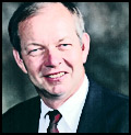 Jim Geringer, Wyoming Governor 1995-2003, Director, Policy and Public Sector
Strategies, Environmental Systems Research Institute (ESRI)
Jim Geringer, a native of Wheatland, Wyoming, earned his B.S. in Mechanical Engineering from Kansas State University. Mr. Geringer served as a project officer on unmanned space programs for the Air Force for NASA, including the Global Positioning Satellite System, early detection/warning systems, the Interim Upper Stage for the Space Shuttle and the Mars Viking Lander, activation of the Peacekeeper missile system and disaster recovery from nuclear, biological and chemical ...Read More.
 Ronald
Beck is a Program Information Specialist in the Land Remote Sensing
Program in the U. S. Geological Survey (USGS.) His primary responsibility
is to work with sister federal agencies, especially NASA, as the USGS prepares
for the next generation of earth observing satellites.
Beck was born and raised in Sioux Falls, SD, graduated from Washington High School in Sioux Falls and has B.A. and M.A. degrees from the University of South Dakota.
He taught one year at the University of South Dakota and 7 years at Briar Cliff College, Sioux City, Iowa, serving for two years as Chairman of the college's English ...Read More.
A career Naval Officer, Art established the Navy's first GIS in the mid-eighties and used it to complete the 1987 military base closure study. GIS proved to be such a powerful tool that Art pursued a GIS career after retiring from the Navy. Upon completion of GIS graduate work at the University of North Carolina, he joined the Atlanta Regional Commission (ARC) serving as the GIS Manager from 1993 to 2007. He was an ESRI software instructor and was in the first group of GIS professionals to receive certification as a GISP. More recently he pioneered the use of oblique imagery in the Atlanta Region for public safety and Homeland Security applications. Art retired early from ARC to join Pictometry International to direct military projects using oblique imagery. He also writes a monthly column for GeoSpatial Solutions aimed at federal GIS users.

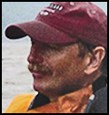 Dr.
David Miller, Dr. David Miller is a Distinguished Teaching Professor
of Geography at SUNY Cortland. He has been teaching GIS courses for more
than 15 years, is an ESRI Authorized GIS instructor, and has written articles
for ArcUser magazine. An outdoorsman, he is an expert walleye
fisherman and is a
member of the National Association for Search and Rescue.
In late May of 2002, after a winter sabbatical focused on reading the Journals of Lewis and Clark ...Read More
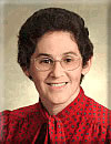
Adena Schutzberg is Executive Editor of Directions Magazine and contributes to its widely-read weekly electronic newsletters and website. Before joining Directions Magazine, Schutzberg founded and edited GIS Monitor for nearly five years.
She is also the Principal of ABS Consulting Group, Inc., a GIS consulting firm providing services to clients including the Open Geospatial Consortium and GIS software and imagery companies.
Before opening her own company, Schutzberg headed U.S. operations for UK-based Cadcorp, and held several positions at ESRI over ...Read More
~2008~

Adena Schutzberg is Executive Editor of Directions Magazine and contributes to its widely-read weekly electronic newsletters and website. Before joining Directions Magazine, Schutzberg founded and edited GIS Monitor for nearly five years.
She is also the Principal of ABS Consulting Group, Inc., a GIS consulting firm providing services to clients including the Open Geospatial Consortium and GIS software and imagery companies.
Before opening her own company, Schutzberg headed U.S. operations for UK-based Cadcorp, and held several positions at ESRI over ...Read More

Vincent Virga has been called "America's foremost picture editor." Vincent Virga is a photography editor who has contributed to over 150 books. He has written three novels and is the co-author of "Eyes of the Nation: A Visual History of the United States." He has researched, edited, designed, and captioned for books by people as diverse as John Wayne, Jane Fonda, Bill and Hillary Clinton.
Vincent worked for eight years with the staff of the Library of Congress to create this book on the history of maps and how they reveal civilizations. John Hebert, Chief of the Geography and Maps division and Ronald Grim, retired curator of the Maps Division, contributed to the book and joined the author for a presentation at the Library of Congress.
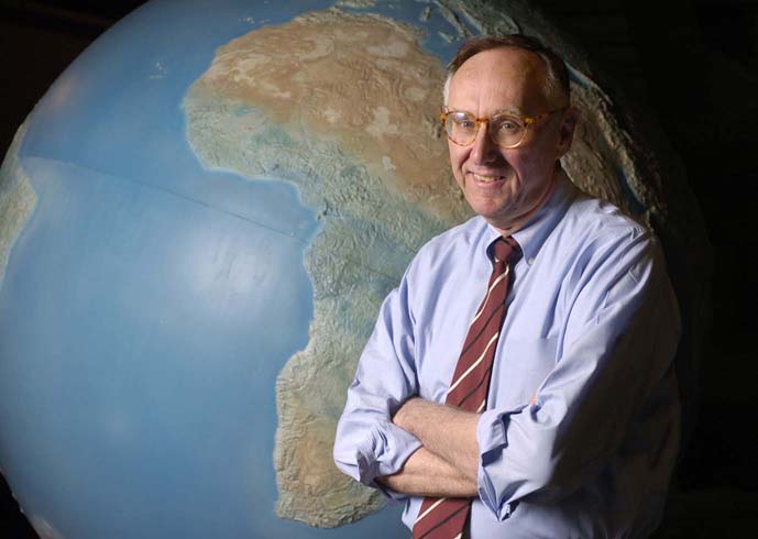
Jack Dangermond with his wife Laura co-founded the Environmental
Systems Research Institute (ESRI), a privately-held Geographic
Information Systems software company in 1969.
Dangermond is the company's President and Chief Exectutive Officer and works
out of ESRI's headquarters in Redlands,
California. Dangermond founded ESRI to perform land
use analysis, however its focus evolved into GIS software development,
highlighted by the release of Arc/INFO in
the early 1980s; the development and marketing of Arc/INFO positioned ESRI
with the dominant market share among ...Read
More
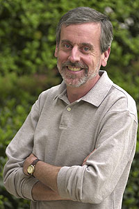
Allen Carroll is chief cartographer and executive vice president of National Geographic Maps. He supervises the editorial and creative efforts of the Society's map division, including its renowned reference and wall maps, globes, and atlases. He led the creation of the Seventh and Eighth editions of the World Atlas, incorporating satellite imagery and innovative thematic maps into the editions and integrating them for the first time with interactive Web resources. Carroll was instrumental in launching the National Geographic MapMachine, its first interactive atlas on the Web. He has spearheaded the creation of many new maps, ranging from decorative wall maps and supplement maps for National Geographic magazine to special projects featuring global biodiversity, conservation, and indigenous cultures. His map designs have won numerous awards, including best in show ...Read More

Eric W. Sanderson is the Associate Director of the Living Landscapes Program at the Wildlife Conservation Society. Sanderson received his Ph.D. in ecology (emphasis in ecosystem and landscape ecology) from the University of California, Davis, in 1998. His research interests include the application of landscape ecology to conservation problems, particularly through geospatial techniques, and the historical and geographical context of conservation, from site-based efforts to global conservation planning. He was the principal architect of the Landscape Species Approach to conservation, Range-wide ...Read More

Ed Parsons is the Geospatial Technologist of Google, with responsibility for evangelising Google’s mission to organise the world’s information using geography, and tools including Google Earth, Google Maps and Google Maps for Mobile.
Parsons was the first Chief Technology Officer in the 200-year-old history of Ordnance Survey, and was instrumental in moving the focus of the organisation from mapping to Geographical Information. Parsons developed technology strategy, identified strategic technology partners, and lead the Ordnance Survey ...Read More

Don Rittner is a long time author, historian, and archeologist of New York's Capital District. He is currently the Schenectady County and City Historian and President of New Netherland Routes, Inc. a non profit organization that is building a replica of the Onrust, the first ship built in New York State in 1614.
Rittner began his career while a student at the University at Albany continuing the work of William B. Efner, Schenectady City Historian. Efner, during the 1930's and 40's, spent much of his time studying the old colonial roads and ...Read More
~2007~

Mark Anderson holds a Ph.D. in Ecology from University of New Hampshire where his researched focused on the viability and spatial assessment of ecological communities in the Northern Appalachian ecoregion. He has been the Director of Conservation Science for the Eastern Region of the Nature Conservancy for fifteen years, providing ...Read More

Erin Aigner is a graphics editor for The New York Times. Every couple of weeks, the Times splurges to publish large, colorful, analytical maps produced by a very bright and talented young graphics editor with formal training in GIS and cartography.
 Don Cooke was a member of the
Census Bureau team that developed the Dual Independent Map Encoding (DIME)
system in 1967.In 1968 he co-founded Urban Data Processing, Inc, now Harte-Hanks
Data Technologies. HHDT is a leader in supplying MCIF services and software
to banks. In 1980, Mr. Cooke founded ...Read More
 Derrick Crandall is
the President and Chief Executive Officer of the American Recreation Coalition,
a position he has held since 1981. He is the Executive Vice President of The
Recreation Roundtable and serves as Chair of the Scenic Byways Coalition and
National Recreation Lakes Coalition and co-chairs the Coalition for Recreational
...Read More
 Michael Jones is the Chief
Technology Officer of Google Earth, which provides distributed geospatial visualization
to users worldwide. He is an accomplished technical presenter, an inventor
with eleven issued US patents, a director on private company boards, and an
advisor to several Silicon Valley projects. He was formerly President & CEO
of ...Read More
 Jim Lorenz leads Microsoft's
Virtual Earth State & Local, as well as Education, sales and marketing.
In this capacity, he is responsible for the introduction and adoption of Virtual
Earth capabilities to U.S. State & Local Government, as well as Education
Public Sector customers.
With more than 10 years as a consumer and ...Read More
 Adena Schutzberg is Executive
Editor of Directions Magazine and contributes to its widely-read weekly electronic
newsletters and website. Before joining Directions Magazine, Schutzberg founded
and edited GIS Monitor for nearly five years.
She is also the Principal of ...Read More

Kris Hughes - Director of the Ontario County Planning Dept.
Richard Iuli - The Climate Project®
~2006~
 Richard
Kaplan has an extensive background in economics, accounting, management,
and executive leadership that have benefited many corporations, start-ups,
universities, and other organizations.
He is currently the President and CEO of Pictometry International Corp., a rapidly growing visual information systems company that is experiencing exponential growth. Mr. Kaplan is also the former President of Richland Industries, Inc. and Max Pies Floor Coverings, a retail floor covering chain. He was Chairman and co-founder ...Read More
 Jay
Benson is vice president of business planning and development in
North America, responsible for the company's pricing, strategic acquisitions
and partnerships. Since joining Tele Atlas in 1999, Benson has held several
positions including director of business management and vice president of
development. In these roles Benson has helped build the company's presence
in several new markets, including the evolving location based services (LBS)
marketplace covering navigation, fleet management, internet and wireless
navigation applications.. Prior to joining Tele Atlas Benson was a management ...Read More
 Michael
Jones is the Chief Technology Officer of Google Earth, which provides
distributed geospatial visualization to users worldwide. He is an accomplished
technical presenter, an inventor with eleven issued US patents, a director
on private company boards, and an advisor to several Silicon Valley projects.
He was formerly President & CEO
of Intrinsic Graphics, Director of Advanced Graphics Software at Silicon Graphics
responsible for OpenGL, Performer and all other graphics APIs, co-founder of
a movie colouring company, and a computer graphics consultant during the 1980s.
 George
Moon has more than twenty-five years experience with complex, multi-user,
spatial information systems. He joined MapInfo Corporation following the
acquisition of the SpatialWare business unit from Unisys Corporation in 1996.
Since that time, Moon has been the driving force in developing MapInfo's
enterprise mapping R&D. Through his leadership, the organization has
developed numerous new products and technologies.
As MapInfo's CTO, Moon's office focuses on standards and their development impacts, public technology briefings and ...Read More
 Christopher
Cappelli is the Director of ESRI's U.S. sales force and the international
Business Partner Program. During his career, he has served as a consultant
and advisor on many large geospatial implementation projects. Since joining
ESRI in 1990, he has held several positions: Regional Manager of ESRI's Philadelphia
office; Account Manager working with clients to define and implement solutions;
and Consultant and Programmer helping users successfully implement and customize
their ESRI solutions. Prior to joining ESRI, he was a GIS Analyst for a large
photogrammetric mapping firm. Chris is currently serving on ...Read More
 Adena
Schutzberg is Executive Editor of Directions Magazine and contributes
to its widely-read weekly electronic newsletters and website. Before joining
Directions Magazine, Schutzberg founded and edited GIS Monitor for nearly
five years.
She is also the Principal of ABS Consulting Group, Inc., a GIS consulting firm providing services to clients including the Open Geospatial Consortium and GIS software and imagery companies.
Before opening her own company, Schutzberg headed U.S. operations for UK-based Cadcorp, and held several positions at ESRI over eight years. She began her career ...Read More
 Bill
Johnson is Assistant Deputy Director & CIO for the New York
State Office of Cyber Security and Critical Infrastructure Coordination.
He functions as Operations Manager for the agency, overseeing both GIS and
Cyber Security. He also Chairs the 18-member NYS GIS Coordinating Body which
oversees the Statewide GIS Coordination Program. Previously, Bill was CSCIC's
Manager of Geographic Information and Critical Infrastructure Coordination.
Prior to the establishment of CSCIC in 2002, he was Deputy Director of the
New York State Center for Geographic Information at the New York ...Read More
 Ian
White is Founder and CEO of Urban Mapping LLC, where he maintains
responsibility for product development and overall growth of the company.
He holds 10 years experience in marketing strategy and product development.
Ian has written for I.D. magazine and Core77 and has been co-author for several
academic journal articles. He holds an MBA from Babson College, BA from McGill
University and also studied in France and Ireland. Ian counts Harvard University,
General Motors, Trader Joe's, Xerox Corporation, Parsons School of Design,
the National Oceanographic and Atmospheric ...Read
More
Ian
White is Founder and CEO of Urban Mapping LLC, where he maintains
responsibility for product development and overall growth of the company.
He holds 10 years experience in marketing strategy and product development.
Ian has written for I.D. magazine and Core77 and has been co-author for several
academic journal articles. He holds an MBA from Babson College, BA from McGill
University and also studied in France and Ireland. Ian counts Harvard University,
General Motors, Trader Joe's, Xerox Corporation, Parsons School of Design,
the National Oceanographic and Atmospheric ...Read
More
 Todd
Fabozzi, Regional Planning Expert, Capital District Regional Planning
Commission
After six coast-to-coast explorations, and after four years teaching junior
high social studies to inner-city students in Los Angeles, Todd returned to
his former home in the Capital Region to attend the Masters of Urban and Regional
Planning program at SUNY Albany. He has since spent the last thirteen years
as a professional geographer and planner working two and a half years for the
Montgomery County Department of Economic Development and Planning, and the
last eleven years with the Capital District ...Read More
 Dr.
Ross S. Whaley, Chairman, Adirondack Park Agency
The New York State Senate approved the Governor’s nomination of Dr. Whaley
as Chairman of the Adirondack Park Agency on September 16, 2003. He brings
to that position more than 30 years experience as a university teacher, researcher
and administrator. He also served as Director of Economics Research for the
United States Forest Service for 6 years. He holds a bachelor’s degree
in forestry and a Ph.D. in natural resource economics from the University of
Michigan.
Since 1984, Whaley has been associated with the ...Read More

Tom Barclay - Microsoft Virtual Earth Imagery Program Manager
