Speakers
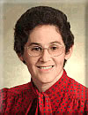
Adena Schutzberg is Executive Editor of Directions Magazine and contributes to its widely-read weekly electronic newsletters and website. Before joining Directions Magazine, Schutzberg founded and edited GIS Monitor for nearly five years.
She is also the Principal of ABS Consulting Group, Inc., a GIS consulting firm providing services to clients including the Open Geospatial Consortium and GIS software and imagery companies.
Before opening her own company, Schutzberg headed U.S. operations for UK-based Cadcorp, and held several positions at ESRI over eight years. She began her career heading Arthur D. Little’s CAD/GIS lab and teaching college geography. She holds a BA in Chemistry from the University of Chicago and an MS in Geography from Pennsylvania State University.
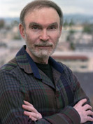
Vincent Virga has been called "America's foremost picture editor." Vincent Virga is a photography editor who has contributed to over 150 books. He has written three novels and is the co-author of "Eyes of the Nation: A Visual History of the United States." He has researched, edited, designed, and captioned for books by people as diverse as John Wayne, Jane Fonda, Bill and Hillary Clinton.
Vincent worked for eight years with the staff of the Library of Congress to create this book on the history of maps and how they reveal civilizations. John Hebert, Chief of the Geography and Maps division and Ronald Grim, retired curator of the Maps Division, contributed to the book and joined the author for a presentation at the Library of Congress.
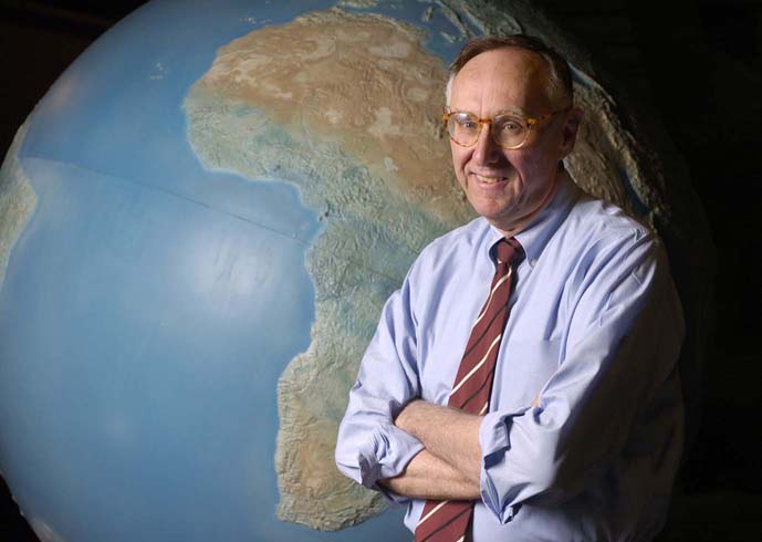
Jack Dangermond with his wife Laura co-founded the Environmental Systems Research Institute (ESRI), a privately-held Geographic
Information Systems software company in 1969.
Dangermond is the company's President and Chief Exectutive Officer and works
out of ESRI's headquarters in Redlands,
California. Dangermond founded ESRI to perform land
use analysis, however its focus evolved into GIS software development, highlighted
by the release of Arc/INFO in
the early 1980s; the development and marketing of Arc/INFO positioned ESRI with
the dominant market share among GIS software developers. Today ESRI is the largest
GIS software developer in the world and its flagship product, ArcGIS traces
its heritage to Dangermond's initial efforts in developing Arc/INFO.
Dangermond completed his undergraduate work at the California State Polytechnic University, Pomona. He earned a Bachelor of Science in environmental science. He then earned a Master of Science degree in environmental science from the University of Minnesota, and a Master of Landscape Architecture degree from the Harvard University Graduate School of Design GSD in 1969. His early work in the school's Laboratory for Computer Graphics and Spatial Analysis (LCGSA) led directly to the development of ESRI's ArcInfo GIS software. He has been awarded honorary doctorate degrees from institutions including Ferris State University, University of Redlands, University of West Hungary and City University in London, England.
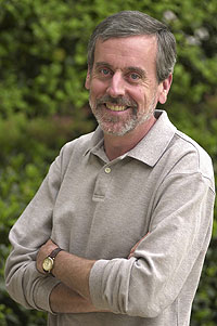
Allen Carroll is chief cartographer and executive vice president of National Geographic Maps. He supervises the editorial and creative efforts of the Society's map division, including its renowned reference and wall maps, globes, and atlases. He led the creation of the Seventh and Eighth editions of the World Atlas, incorporating satellite imagery and innovative thematic maps into the editions and integrating them for the first time with interactive Web resources. Carroll was instrumental in launching the National Geographic MapMachine, its first interactive atlas on the Web. He has spearheaded the creation of many new maps, ranging from decorative wall maps and supplement maps for National Geographic magazine to special projects featuring global biodiversity, conservation, and indigenous cultures. His map designs have won numerous awards, including best in show at the American Congress on Surveying and Mapping annual design competition. He advises the federal government as a member of the National Geospatial Advisory Committee.
From 1991 to 1995 Carroll was art director of National Geographic, producing historical, scientific, and informational artwork. Carroll received two gold medals from the Society of Illustrators for his work during this period, and depicted subjects ranging from the evolution of planet Earth to the workings of the immune system. He served as art director of the Society's Historical Atlas of the United States, a richly illustrated history of America in maps, pictures and text produced for the Society’s centennial in 1988.
Prior to joining the Society in 1983, Carroll was a free-lance illustrator and designer. Self-trained in design, illustration, and cartography and an avid bird watcher, Carroll is a magna cum laude graduate of Connecticut College, and was born in Indianapolis, Indiana.

Eric W. Sanderson is the Associate Director of the Living Landscapes Program at the Wildlife Conservation Society. Sanderson received his Ph.D. in ecology (emphasis in ecosystem and landscape ecology) from the University of California, Davis, in 1998. His research interests include the application of landscape ecology to conservation problems, particularly through geospatial techniques, and the historical and geographical context of conservation, from site-based efforts to global conservation planning. He was the principal architect of the Landscape Species Approach to conservation, Range-wide Priority-setting (a planning method for saving species across their historical ranges), and the Human Footprint, a map of human influence on the planet today. He has contributed to species planning efforts for lions, tigers, bears, jaguars, tapirs, peccaries, American crocodiles, North American bison and Mongolian gazelle; and landscape planning conservation efforts in Argentina, Tanzania, Mongolia, and the Greater Yellowstone Ecosystem and the Adirondack Park, in the USA. He is also the leader of the Mannahatta Project, an effort to understand the historical ecology of New York City in relationship to the sustainable city of the future.
His work has been featured in the New York Times, the New Yorker, National Public Radio, and National Geographic, among others.

Ed Parsons is the Geospatial Technologist of Google, with responsibility for evangelising Google’s mission to organise the world’s information using geography, and tools including Google Earth, Google Maps and Google Maps for Mobile.
Parsons was the first Chief Technology Officer in the 200-year-old history of Ordnance Survey, and was instrumental in moving the focus of the organisation from mapping to Geographical Information. Parsons developed technology strategy, identified strategic technology partners, and lead the Ordnance Survey Research Labs, leading an overall team of more than 200 people.
Parsons came to the Ordnance Survey from Autodesk, where he was EMEA Applications Manager for the Geographical Information Systems (GIS) Division. During his tenure, he helped Autodesk to become one of the key providers of GIS software.Earlier in his career he was a Senior Lecturer at Kingston University, where he helped establish Europe’s first undergraduate course in GIS.
Parsons earned a Master degree in Applied Remote Sensing from Cranfield Institute of Technology and is a fellow of the Royal Geographical Society, London. He is the author of numerous articles, professional papers and presentations to International Conferences, and has developed one of most popular Weblogs in the Geospatial Industry, www.edparsons.com.

Don Rittneris a long time author, historian, and archeologist of New York's Capital District. He is currently the Schenectady County and City Historian and President of New Netherland Routes, Inc. a non profit organization that is building a replica of the Onrust, the first ship built in New York State in 1614.
Rittner began his career while a student at the University at Albany continuing the work of William B. Efner, Schenectady City Historian. Efner, during the 1930's and 40's, spent much of his time studying the old colonial roads and taverns of the famous Pine Bush region between Albany and Schenectady. Rittner continued Efner's work when he became the Albany City Archeologist in 1973 and began excavating colonial tavern sites in the Pine Bush. He also finished Efner's work in relocating the old King's Highway and in 1975 erected sixteen King's Highway markers that are still visible along the entire route.
He published his first book in 1975, Pine Bush - Albany's Last Frontier, while a student at the University at Albany. This book helped saved hundreds of endangered Pine Bush wilderness. Since then he has published 26 books in history, science, computers, and technology. He wrote the first Internet book (Ecolinking) in 1990 connecting the world wide environmental community using online services (before the Internet as we know it). He has written several computer books, seven history books and three encyclopedias on Meteorology, Biology and Chemistry. From 1999 to 2005, he wrote a weekly history column for the Troy Record called Heritage on the Hudson.
Besides writing and archeology, Don manages the Capital District Preservation Task Force listserv that provides daily newspaper coverage in history, planning, and preservation to more than 80 leading preservation and environmental groups.
The Schenectady County historian position is a state mandated position since 1919 with responsibilities that include providing guidance and support to the municipal historians in their counties and of serving as a conduit of information between the State Historian in Albany and the local historians in their counties.
