Speakers

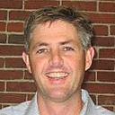
James Fee is the Chief Evangelist for WeoGeo (www.weogeo.com). James has extensive experience in GIS development (ESRI, Autodesk, FME, OSGeo) and cloud-based SaaS soltuions. He was instrumental in enabling the Greater New Orleans Community Data Center to track the recovery of New Orleans from Hurricane Katrina and previous clients span the Department of Defense (Navy, USMC, Army and Air Force), Department of Interior, State and Local Governments, Private Sector and Non-profits.
As WeoGeo's Chief Evangelist, James helps people organize, share and monetize their geo-content. WeoGeo's Library is a browser-interfaced cataloging system for indexing, sharing, and delivering customized geospatial content with powerful server-side Spatial ETL provides spatial/spectral clipping, projecting to alternate Coordinate Systems, and file-format translation.
James blogs about geospatial technology at his blog (www.spatiallyadjusted.com) and has helped develop an online community culminating in Planet Geospatial. He is a frequent presenter at GIS conferences around the world and is also a regular columnist for GeoInformatics magazine.

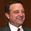
Ted Morgan founded Skyhook Wireless with Michael Shean in 2003 to capitalize on the explosive growth of Wi-Fi usage and the emerging demand for location-based services. Prior to founding Skyhook, Mr. Morgan was the Vice President of Marketing for edocs Inc., a provider of customer self-service solutions that was sold to Siebel Systems in January 2005. At edocs, he ran marketing communications, inside sales, product marketing, and product management. Prior to edocs, Mr. Morgan was Group Product Manager for Open Market, one of the early leaders of the e-commerce revolution. Prior to that, he was a product manager for Harbinger Net Services in Atlanta. Prior to the technology industry, Mr. Morgan spent four years in the financial services industry, as part of Donaldson, Lufkin & Jenrette, Alliance Capital, and Allen & Company. Mr. Morgan has an undergraduate degree in mathematics from Georgetown University and an MBA from the University of Chicago.

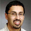
Stu Rich is a Partner and Principal of Penobscot Bay Media with more than 14 years experience developing database applications and geographic information systems for government and non-government environmental organizations across the US, Canada and Japan. He has several years of extensive geographic information systems (GIS) experience, with an expertise in ESRI technology, which includes project management, data analysis and modeling, as well as workflow methodology design work. Stuart's strengths are seen in his work as a system architect, a business process analyst and strategic planning manager. For a first hand look at Stuart's newest geospatial experiences visit his blog at http://spatialexplorations.net/.

Nicholas Roy is a Associate Professor of Aeronautics and Astronautics Department of Aeronautics and Astronautics, Member of MIT's Robust Robotics Group
B.Sc., 1995, McGill University
M.Sc., 1997, McGill University
Ph.D., 2003, Carnegie Mellon University
Specialization and Research Interests Robotics - Machine Learning, Autonomous Systems, Planning and Reasoning, Human-Computer Interaction Teaching Interests Principles of Autonomy and Decision-Making; Real-time Systems and Software, Robotics: Science and Systems
Society Memberships - American Association for Artificial Intelligence; Institute for Electrical and Electronics Engineers

Jason Hyon is the Chief Technologist for NASA/JPL Earth Science and Technology Directorate. Jason Hyon’s research interests are in information technology and lasers for remote sensing. He has led NASA’s Data Distribution Laboratory for archiving and distribution technology for remote sensing data and manages remote sensing instrument technology developments at JPL. He has managed developments of NASA Earth science ground data systems for NASA's EOS and ESSP missions, and leads a program to develop active and passive remote sensing instruments for space. He is currently leading a team to develop an infrastructure to seamlessly integrate remote sensing data into GIS framework (ESRI). He received his B.A. in Mathematics and Physics at Occidental College in 1986 and his MSEE at the University of Southern California in 1988.

Steve Coast is founder of OpenStreetMap a collaborative map of the world made by people like you. Known and respected highly for his work on geo webs, his thoughts on crowdsourcing, datasharing, open source and the future of the Geo Web. Steve has worked in many heavy lifting computing applications around open systems before co-founding a web consultancy firm with Nick Black in 2006. In 2008 this became CloudMade after investment by Sunstone Capital. Steve lives on planes and in airports and is most easily contacted by email.