Past Summit Speakers
2008
Jack Dangermond - ESRI, Allen Carroll - National Geographic, Ed Parsons - Google, Vincent Virga - Author
Adena Schutzberg - Directions Magazine, Eric Sanderson - Mannahatta Project, Don Rittner - Onrust Project
2007
Mark Anderson - Nature Conservancy, Don Cooke - Geographic Data Technology, Derrick Crandall - American Recreation Coalition, Erin Aigner - The New York Times, Michael Jones - Google Earth, Adena Schutzberg - Directions Magazine, Jim Lorenz - Microsoft's Virtual Earth, Richard Iuli - The Climate Project®, Kris Hughes - Director of the Ontario County Planning Dept.
2006
Richard Kaplan - Pictometry, Jay Benson - TeleAtlas, George Moon - MapInfo, Chris Cappelli - U.S. Sales ESRI, Michael Jones - Google Earth, Tom Barclay - Microsoft Virtual Earth, Bill Johnson - NYSGIS, Ian White - Urban Mapping, Adena Schutzberg - Directions Magazine, Todd Fabozzi - Capital District Regional Planning Commission, Ross Whaley - Adirondack Park Agency
~2008~
Adena Schutzberg is Executive Editor of Directions Magazine and contributes to its widely-read weekly electronic newsletters and website. Before joining Directions Magazine, Schutzberg founded and edited GIS Monitor for nearly five years.
She is also the Principal of ABS Consulting Group, Inc., a GIS consulting firm providing services to clients including the Open Geospatial Consortium and GIS software and imagery companies.
Before opening her own company, Schutzberg headed U.S. operations for UK-based Cadcorp, and held several positions at ESRI over ...Read More
Vincent Virga has been called "America's foremost picture editor." Vincent Virga is a photography editor who has contributed to over 150 books. He has written three novels and is the co-author of "Eyes of the Nation: A Visual History of the United States." He has researched, edited, designed, and captioned for books by people as diverse as John Wayne, Jane Fonda, Bill and Hillary Clinton.
Vincent worked for eight years with the staff of the Library of Congress to create this book on the history of maps and how they reveal civilizations. John Hebert, Chief of the Geography and Maps division and Ronald Grim, retired curator of the Maps Division, contributed to the book and joined the author for a presentation at the Library of Congress.
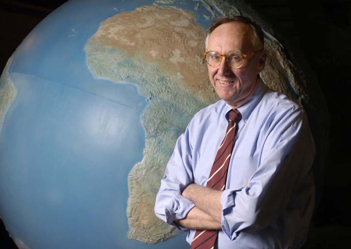
Jack Dangermond with his wife Laura co-founded the Environmental
Systems Research Institute (ESRI), a privately-held Geographic
Information Systems software company in 1969.
Dangermond is the company's President and Chief Exectutive Officer and works
out of ESRI's headquarters in Redlands,
California. Dangermond founded ESRI to perform land
use analysis, however its focus evolved into GIS software development,
highlighted by the release of Arc/INFO in
the early 1980s; the development and marketing of Arc/INFO positioned ESRI
with the dominant market share among ...Read
More

Allen Carroll is chief cartographer and executive vice president of National Geographic Maps. He supervises the editorial and creative efforts of the Society's map division, including its renowned reference and wall maps, globes, and atlases. He led the creation of the Seventh and Eighth editions of the World Atlas, incorporating satellite imagery and innovative thematic maps into the editions and integrating them for the first time with interactive Web resources. Carroll was instrumental in launching the National Geographic MapMachine, its first interactive atlas on the Web. He has spearheaded the creation of many new maps, ranging from decorative wall maps and supplement maps for National Geographic magazine to special projects featuring global biodiversity, conservation, and indigenous cultures. His map designs have won numerous awards, including best in show ...Read More

Eric W. Sanderson is the Associate Director of the Living Landscapes Program at the Wildlife Conservation Society. Sanderson received his Ph.D. in ecology (emphasis in ecosystem and landscape ecology) from the University of California, Davis, in 1998. His research interests include the application of landscape ecology to conservation problems, particularly through geospatial techniques, and the historical and geographical context of conservation, from site-based efforts to global conservation planning. He was the principal architect of the Landscape Species Approach to conservation, Range-wide ...Read More

Ed Parsons is the Geospatial Technologist of Google, with responsibility for evangelising Google’s mission to organise the world’s information using geography, and tools including Google Earth, Google Maps and Google Maps for Mobile.
Parsons was the first Chief Technology Officer in the 200-year-old history of Ordnance Survey, and was instrumental in moving the focus of the organisation from mapping to Geographical Information. Parsons developed technology strategy, identified strategic technology partners, and lead the Ordnance Survey ...Read More

Don Rittner is a long time author, historian, and archeologist of New York's Capital District. He is currently the Schenectady County and City Historian and President of New Netherland Routes, Inc. a non profit organization that is building a replica of the Onrust, the first ship built in New York State in 1614.
Rittner began his career while a student at the University at Albany continuing the work of William B. Efner, Schenectady City Historian. Efner, during the 1930's and 40's, spent much of his time studying the old colonial roads and ...Read More
~2007~

Mark Anderson holds a Ph.D. in Ecology from University of New Hampshire where his researched focused on the viability and spatial assessment of ecological communities in the Northern Appalachian ecoregion. He has been the Director of Conservation Science for the Eastern Region of the Nature Conservancy for fifteen years, providing ...Read More

Erin Aigner is a graphics editor for The New York Times. Every couple of weeks, the Times splurges to publish large, colorful, analytical maps produced by a very bright and talented young graphics editor with formal training in GIS and cartography.
 Don Cooke was a member of the
Census Bureau team that developed the Dual Independent Map Encoding (DIME)
system in 1967.In 1968 he co-founded Urban Data Processing, Inc, now Harte-Hanks
Data Technologies. HHDT is a leader in supplying MCIF services and software
to banks. In 1980, Mr. Cooke founded ...Read More
 Derrick Crandall is
the President and Chief Executive Officer of the American Recreation Coalition,
a position he has held since 1981. He is the Executive Vice President of The
Recreation Roundtable and serves as Chair of the Scenic Byways Coalition and
National Recreation Lakes Coalition and co-chairs the Coalition for Recreational
...Read More
 Michael Jones is the Chief
Technology Officer of Google Earth, which provides distributed geospatial visualization
to users worldwide. He is an accomplished technical presenter, an inventor
with eleven issued US patents, a director on private company boards, and an
advisor to several Silicon Valley projects. He was formerly President & CEO
of ...Read More
 Jim Lorenz leads Microsoft's
Virtual Earth State & Local, as well as Education, sales and marketing.
In this capacity, he is responsible for the introduction and adoption of Virtual
Earth capabilities to U.S. State & Local Government, as well as Education
Public Sector customers.
With more than 10 years as a consumer and ...Read More
 Adena Schutzberg is Executive
Editor of Directions Magazine and contributes to its widely-read weekly electronic
newsletters and website. Before joining Directions Magazine, Schutzberg founded
and edited GIS Monitor for nearly five years.
She is also the Principal of ...Read More

Kris Hughes - Director of the Ontario County Planning Dept.
Richard Iuli - The Climate Project®
~2006~
 Richard
Kaplan has an extensive background in economics, accounting, management,
and executive leadership that have benefited many corporations, start-ups,
universities, and other organizations.
He is currently the President and CEO of Pictometry International Corp., a rapidly growing visual information systems company that is experiencing exponential growth. Mr. Kaplan is also the former President of Richland Industries, Inc. and Max Pies Floor Coverings, a retail floor covering chain. He was Chairman and co-founder ...Read More
 Jay
Benson is vice president of business planning and development in
North America, responsible for the company's pricing, strategic acquisitions
and partnerships. Since joining Tele Atlas in 1999, Benson has held several
positions including director of business management and vice president of
development. In these roles Benson has helped build the company's presence
in several new markets, including the evolving location based services (LBS)
marketplace covering navigation, fleet management, internet and wireless
navigation applications.. Prior to joining Tele Atlas Benson was a management ...Read More
 Michael
Jones is the Chief Technology Officer of Google Earth, which provides
distributed geospatial visualization to users worldwide. He is an accomplished
technical presenter, an inventor with eleven issued US patents, a director
on private company boards, and an advisor to several Silicon Valley projects.
He was formerly President & CEO
of Intrinsic Graphics, Director of Advanced Graphics Software at Silicon Graphics
responsible for OpenGL, Performer and all other graphics APIs, co-founder of
a movie colouring company, and a computer graphics consultant during the 1980s.
 George
Moon has more than twenty-five years experience with complex, multi-user,
spatial information systems. He joined MapInfo Corporation following the
acquisition of the SpatialWare business unit from Unisys Corporation in 1996.
Since that time, Moon has been the driving force in developing MapInfo's
enterprise mapping R&D. Through his leadership, the organization has
developed numerous new products and technologies.
As MapInfo's CTO, Moon's office focuses on standards and their development impacts, public technology briefings and ...Read More
 Christopher
Cappelli is the Director of ESRI's U.S. sales force and the international
Business Partner Program. During his career, he has served as a consultant
and advisor on many large geospatial implementation projects. Since joining
ESRI in 1990, he has held several positions: Regional Manager of ESRI's Philadelphia
office; Account Manager working with clients to define and implement solutions;
and Consultant and Programmer helping users successfully implement and customize
their ESRI solutions. Prior to joining ESRI, he was a GIS Analyst for a large
photogrammetric mapping firm. Chris is currently serving on ...Read More
 Adena
Schutzberg is Executive Editor of Directions Magazine and contributes
to its widely-read weekly electronic newsletters and website. Before joining
Directions Magazine, Schutzberg founded and edited GIS Monitor for nearly
five years.
She is also the Principal of ABS Consulting Group, Inc., a GIS consulting firm providing services to clients including the Open Geospatial Consortium and GIS software and imagery companies.
Before opening her own company, Schutzberg headed U.S. operations for UK-based Cadcorp, and held several positions at ESRI over eight years. She began her career ...Read More
 Bill
Johnson is Assistant Deputy Director & CIO for the New York
State Office of Cyber Security and Critical Infrastructure Coordination.
He functions as Operations Manager for the agency, overseeing both GIS and
Cyber Security. He also Chairs the 18-member NYS GIS Coordinating Body which
oversees the Statewide GIS Coordination Program. Previously, Bill was CSCIC's
Manager of Geographic Information and Critical Infrastructure Coordination.
Prior to the establishment of CSCIC in 2002, he was Deputy Director of the
New York State Center for Geographic Information at the New York ...Read More
 Ian
White is Founder and CEO of Urban Mapping LLC, where he maintains
responsibility for product development and overall growth of the company.
He holds 10 years experience in marketing strategy and product development.
Ian has written for I.D. magazine and Core77 and has been co-author for several
academic journal articles. He holds an MBA from Babson College, BA from McGill
University and also studied in France and Ireland. Ian counts Harvard University,
General Motors, Trader Joe's, Xerox Corporation, Parsons School of Design,
the National Oceanographic and Atmospheric ...Read
More
Ian
White is Founder and CEO of Urban Mapping LLC, where he maintains
responsibility for product development and overall growth of the company.
He holds 10 years experience in marketing strategy and product development.
Ian has written for I.D. magazine and Core77 and has been co-author for several
academic journal articles. He holds an MBA from Babson College, BA from McGill
University and also studied in France and Ireland. Ian counts Harvard University,
General Motors, Trader Joe's, Xerox Corporation, Parsons School of Design,
the National Oceanographic and Atmospheric ...Read
More
 Todd
Fabozzi, Regional Planning Expert, Capital District Regional Planning
Commission
After six coast-to-coast explorations, and after four years teaching junior
high social studies to inner-city students in Los Angeles, Todd returned to
his former home in the Capital Region to attend the Masters of Urban and Regional
Planning program at SUNY Albany. He has since spent the last thirteen years
as a professional geographer and planner working two and a half years for the
Montgomery County Department of Economic Development and Planning, and the
last eleven years with the Capital District ...Read More
 Dr.
Ross S. Whaley, Chairman, Adirondack Park Agency
The New York State Senate approved the Governor’s nomination of Dr. Whaley
as Chairman of the Adirondack Park Agency on September 16, 2003. He brings
to that position more than 30 years experience as a university teacher, researcher
and administrator. He also served as Director of Economics Research for the
United States Forest Service for 6 years. He holds a bachelor’s degree
in forestry and a Ph.D. in natural resource economics from the University of
Michigan.
Since 1984, Whaley has been associated with the ...Read More

Tom Barclay - Microsoft Virtual Earth Imagery Program Manager