We are the
NYS GIS
Association


About Us

The NYS GIS Association represents the interests of the entire geospatial community within NY.
Geocon 2025
![]()
October 8th – 10th, in Lake Placid, NY. General registration coming soon!
Sponsor information is available now.
Calendar
![]()
Upcoming events and meetings within the New York geospatial community.
Membership Drive 2024
![]()
Is your NYS GIS Association Membership up to date?
NYS GIS Association News

NYS GIS Association Election Results !!!
NYS GIS Association Election Results Congratulations to President-elect Karyn Senneff Tareen (Geocove, Inc.) and new Directors to the Board, Stephanie Rockwell (NYS Canal Corporation) and Jiin Wen (NYC Economic Development Corporation). Here's to a good year!

2020 Application/Dashboard Winner: Rockland County Planning Department
Rockland County Planning Department | COVID-19 Application/Dashboard Award Rockland County developed and launched a COVID-19 HUB along with various related dashboards: Rockland County COVID-19 Dashboard, Rockland Unpause Dashboard, Rockland’s Early Warning Dashboard....

2020 GIS Champion: Doug Schuetz
Doug Schuetz | 2020 Fight Against COVID-19 GIS Champion Award Doug Schuetz worked with the Health Department and his GIS team to not only build useful public dashboards to track COVID, but also set up a geocoding application. Based on county and state SAM data, this...

2020 Application/Dashboard Winner: New York University
New York University | COVID-19 Application/Dashboard Award This project describes a unique dataset of 5,065 records documenting the behavior of 6,075 individuals around 19 hospitals and urgent care clinics across four of New York’s five boroughs at the height of the...

2020 GIS Champion: Richard Reichert
Richard Reichert | 2020 Fight Against COVID-19 GIS Champion Award Rick Reichert was instrumental in creating and maintaining Oneida County’s COVID-19 status dashboard. The dashboard includes mapping that traces the statewide spread of the pandemic as well as detailing...
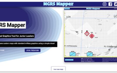
eSpatially – MGRS Mapper: Software for Military Operations Mapping
The latest post from NYS GIS Association member Sam Wear, “MGRS Mapper: Software for Military Operations Mapping”, posted November 24, 2020, is available on his website eSpatially New York. "Developed entirely with JavaScript the application enables users to easily...
Subscribe to Our Weekly News Summary
Join our mailing list to receive the latest news and updates from the NYS GIS Association.