Speakers

Max Baber is Director of Academic Programs at the United States Geospatial Intelligence Foundation (USGIF), managing accreditation of university Geospatial Intelligence (GEOINT) certificate programs and supporting related academic initiatives. Dr. Baber received a Ph.D. in Geography from the University of Georgia in 1999 and an M.A. in Geography from Georgia State University in 1993. He has served in faculty appointments with the Master of Science in Geographic Information Systems program at the University of Redlands and Departments of Geography at Samford University and the University of Northern Colorado. He has developed and implemented a number of pedagogical geographic information science projects supported with funding from a number of sources including the National Science Foundation. He is a member of the U.S. National Committee for the International Cartographic Association (USNC-ICA), serves on the board of directors for the Cartography and Geographic Information Society (CaGIS), and is a Fellow of the British Cartographic Society (BCS).
 Alyssa Wright is a graduate of MIT's Media Lab and NYU's Interactive Telecommunications Program, Alyssa comes to OpenGeo with breadth and wealth of experience in information architecture, editing, graphic and interaction design, and project management.
She leads product management of the OpenGeo Suite, while also managing diverse client accounts. Cartography/Research - Helped coordinate the digital acquisition of New York City maps from the 1600s to present day. Simplified GIS data for movie sponsored by the City Museum of New York. Administration/Coordination/Design - Operated as a liaison between students, faculty and staff of the Institute of Film and Television at the NYU Graduate Film Department. Flexible presentation skills, ranging from written correspondence and budget spreadsheets to interior design and event planning. Interaction/Project Management - Monitored various websites within the interactive arm of Messner Vetere Berger McNamee Schmetterer. Managed quality standards of current sites while assisting with the research and production of upcoming campaigns.
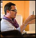 Nicholas de Monchaux, assistant professor of Architecture and Urban Design at UC Berkeley, is an architect and urbanist whose work examines the intersections of nature, technology, and cities. Fascinated by the persistent failure of architects to grasp and instrumentalize the complex nature of urban environments, de Monchaux's work examines the particular role of architecture in civic transformation.
de Monchaux's Local Code/Real Estates, a parametric study of ecologically transformed "gutterspace" was a finalist in the WPA 2.0 Competition in 2009 and was featured at the 2010 Biennial of the Americas. Through the use of GIS, de Monchaux has identified thousands of publicly owned abandoned sites in major US cities and imagines this distributed, vacant landscape as a new urban system. Using digital design techniques, a landscape proposal for each site is tailored to local conditions, optimizing thermal and hydrological performance to enhance the whole city's ecology-and relieving burdens on existing infrastructure. Local Code's quantifiable effects on energy usage and stormwater remediation eradicate the need for more expensive, yet invisible, sewer and electrical upgrades. In addition, the project uses citizen participation to conceive a new, more public infrastructure as well-a robust network of urban greenways with tangible benefits to the health and safety of every citizen.
de Monchaux received his B.A. with distinction in Architecture, from Yale, and his Professional Degree (M.Arch.) from Princeton. He has worked as a designer for Michael Hopkins & Partners in London, and Diller, Scofidio + Renfro in New York. de Monchaux's work has been published and reviewed in Log, Architectural Design, the New York Times, and the Wall Street Journal, and have been supported by the Graham Foundation for Advanced Studies in the Fine Arts, the Macdowell Colony, the Santa Fe Institute, and the Smithsonian Institution. He has received design awards and citations from the International Union of Architects, Pamphlet Architecture, and the Van Alen Institute, who awarded him the 2000 John Dinkeloo Memorial Fellowship at the American Academy in Rome.
He is the author of Spacesuit: Fashioning Apollo (MIT Press, 2011), an architectural history of the Apollo 11 spacesuit, that was recently featured on NPR's Science Friday with Ira Flatow. His biography and collected works, together with interactive downloads of the Local Code/Real Estate project, are available at nicholas.demonchaux.com.
 Michael W. Dobson, Ph.D.
President, TeleMapics LLC is recognized expert in mapping and GIS with over twenty-five years of experience in business, government and research dealing with issues and applications of geographic data for use in the development of market leading products, tools and services.
Selected Professional experience
Chief Technology Officer and Executive Vice President of Engineering, go2 Systems, Inc.
Served as corporate officer responsible for engineering, technology, IT and product development at go2 systems, the leading provider and distributor of spatially indexed business directories and LBS applications designed for the wireless/cellular Internet. go2 provided location based directory services to MSN Wireless, AT&T wireless, Sprint, Nextel, Verizon and other major wireless carriers in the U.S.
Chief Technologist, Vice President of New Business Development and Chief Cartographer, Rand McNally & Company
Served as corporate officer responsible for technology, Geospatial Information and mapping. Managed over three hundred team members involved in Product Development (systems developers, software developers, GIS specialists and Geospatial scientists) supporting the consumer, commercial, educational and transportation divisions of Rand McNally. In addition, Dr. Dobson was responsible for business development activities including strategic partnerships and acquisitions.
 Kyle Schmackpfeffer is the director of commercial and responsive systems at ITT Geospatial Systems. Schmackpfeffer is responsible for meeting his segment's orders, sales and profitability commitments, as well as for the successful execution of current programs and the capture of new commercial remote sensing and responsive space programs.
ITT Geospatial Systems is a global supplier of innovative night vision, remote sensing and navigation solutions that provide sight and situational awareness at the space, airborne, ground and soldier levels. From the lunar orbiter missions of the 1960s to the new James Webb Space Telescope, ITT has been a part of every major NASA mission. Since the 1960s, ITT has developed precision optical components for ground-based telescopes, electro-optical systems for space-based observatories, focal plane arrays for commercial remote sensing satellites, imagers and sounders for our nation's meteorological systems, navigation systems and components for every GPS satellite ever launched, cameras to image the Moon, and imaging sensors for space exploration. Prior to this position, Schmackpfeffer served as the program manager on the GeoEye-1 high-resolution commercial remote sensing imaging payload program. In this position, he was responsible for the cost, schedule, and technical performance of the ITT team on the GeoEye-1 program. He also was a program manager for the company's Space Control and Missile Defense group. Responsibilities included business development and program start-up and management.
Preceding ITT, Schmackpfeffer was employed by Eastman Kodak Company from 1986 to 2005, where he held such titles as product manager and program chief engineer and systems engineering lead. Responsibilities included the commercialization of digital imagery compression and sharing software, daily communication of status/issues to the customer, ensuring the maturity and traceability of specifications/ requirements, and the closure of action items and verification activities.
Schmackpfeffer holds a Bachelor of Science degree in Optics from the University of Rochester.
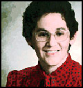 Adena Schutzberg is Executive Editor of Directions Magazine and contributes
to its widely-read weekly electronic newsletters and website. Before joining
Directions Magazine, Schutzberg founded and edited GIS Monitor for nearly five
years.
She is also the Principal of ABS Consulting Group, Inc., a GIS consulting firm providing services to clients including GIS software, data and imagery companies.
Before opening her own company, Schutzberg headed U.S. operations for UK-based Cadcorp, and held several positions at ESRI over eight years. She began her career heading Arthur D. Little's CAD/GIS lab and teaching college geography. She holds a BA in Chemistry from the University of Chicago and an MS in Geography from Pennsylvania State University.
 Learon Dalby serves as the GIS Program Manager for the Arkansas Geographic Information Office (AGIO). He began his career with the AGIO in 2000 where he is responsible for managing a number of statewide programs. Learon Dalby received his Bachelor of Science degree in Biology from the University of Arkansas at Little Rock.
Learon has developed a distinguished career in a very short time. His role as a state leader in the Arkansas Geographic Information Office has benefitted the entire state. He led the original project team that stood up GeoStor as a state operation working with university and state officials to make the transition successful. Learon has become a recognized leader in facilitating, managing and advising regional and statewide imagery projects.
In 2008, Learon rose to the office of President in the National States Geographic Information Council. He has served on the Mid-America GIS Board of Directors, received both the NSGIC and AR GIS Users Outstanding Service Awards and has provided keynote discussions at regional and national meetings. Learon's straightforward and open approach makes him at ease with GIS corporate leaders, government executives, State GIO's, members of the Arkansas Legislature or in a casual conversation with a practitioner. Learon is always exploring and testing creative new ideas for how GIS can be developed and used.
Learon resides in Little Rock, Arkansas with his wife, two daughters and three sons. Throughout his professional career, Learon has balanced a heavy work schedule and been devoted to family life, yet still finds time to enjoy the duck woods. You can follow him on Twitter @learondalby.